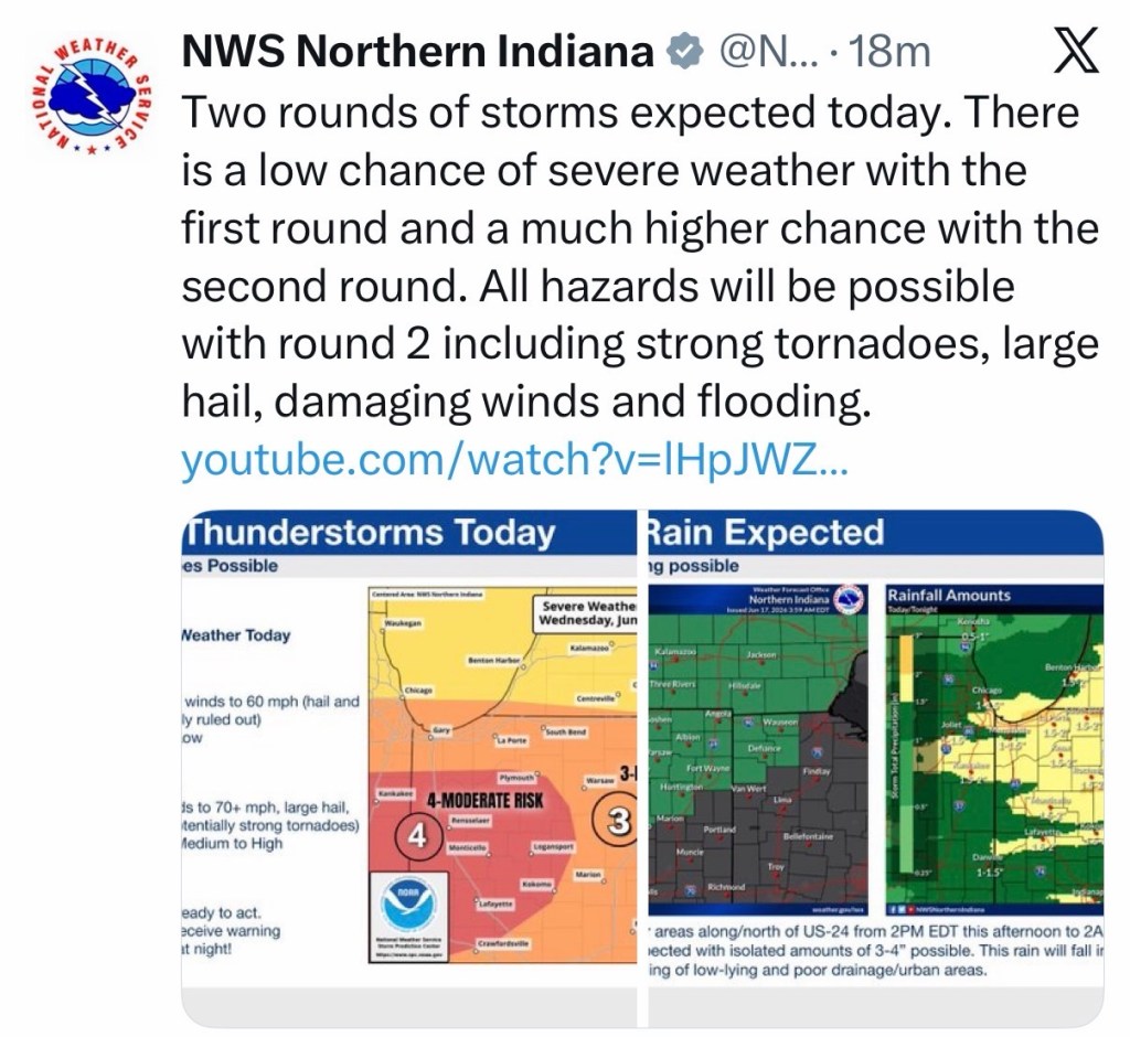
(6-17-26) The Stateline area continues you see severe weather conditions.
All threats appear possible, including damaging wind, large hail, and a few tornadoes between 10 PM Wednesday and 4 AM Thursday.
Hazardous Weather Outlook
National Weather Service Wilmington OH
325 AM EDT Wed Jun 17 2026

INZ050-058-059-066-073>075-080-KYZ089>100-OHZ026-034-035-042>046-
051>056-060>065-070>074-077>082-088-181100-
Wayne-Fayette-Union-Franklin-Ripley-Dearborn-Ohio-Switzerland-
Carroll-Gallatin-Boone-Kenton-Campbell-Owen-Grant-Pendleton-Bracken-
Robertson-Mason-Lewis-Hardin-Mercer-Auglaize-Darke-Shelby-Logan-
Delaware-Miami-Champaign-Clark-Madison-Licking-Preble-Montgomery-
Greene-Pickaway-Fairfield-Butler-Warren-Clinton-Ross-Hocking-
Hamilton-Clermont-Brown-Highland-Adams-Pike-Scioto-
325 AM EDT Wed Jun 17 2026

This Hazardous Weather Outlook is for east central Indiana,
southeast Indiana, northeast Kentucky, northern Kentucky, central
Ohio, south central Ohio, southwest Ohio and west central Ohio.

.DAY ONE...Today and tonight.

Showers and thunderstorms will develop through late afternoon and
then move southeast across the area overnight. Some severe storms
will be possible. Damaging wind is the primary threat. However,
large hail, localized flash flooding and a few tornadoes will also
be possible.

.DAYS TWO THROUGH SEVEN...Thursday through Tuesday.

The probability for widespread hazardous weather is low.

.SPOTTER INFORMATION STATEMENT...

Spotter activation is not expected at this time.

$$


Last night….

